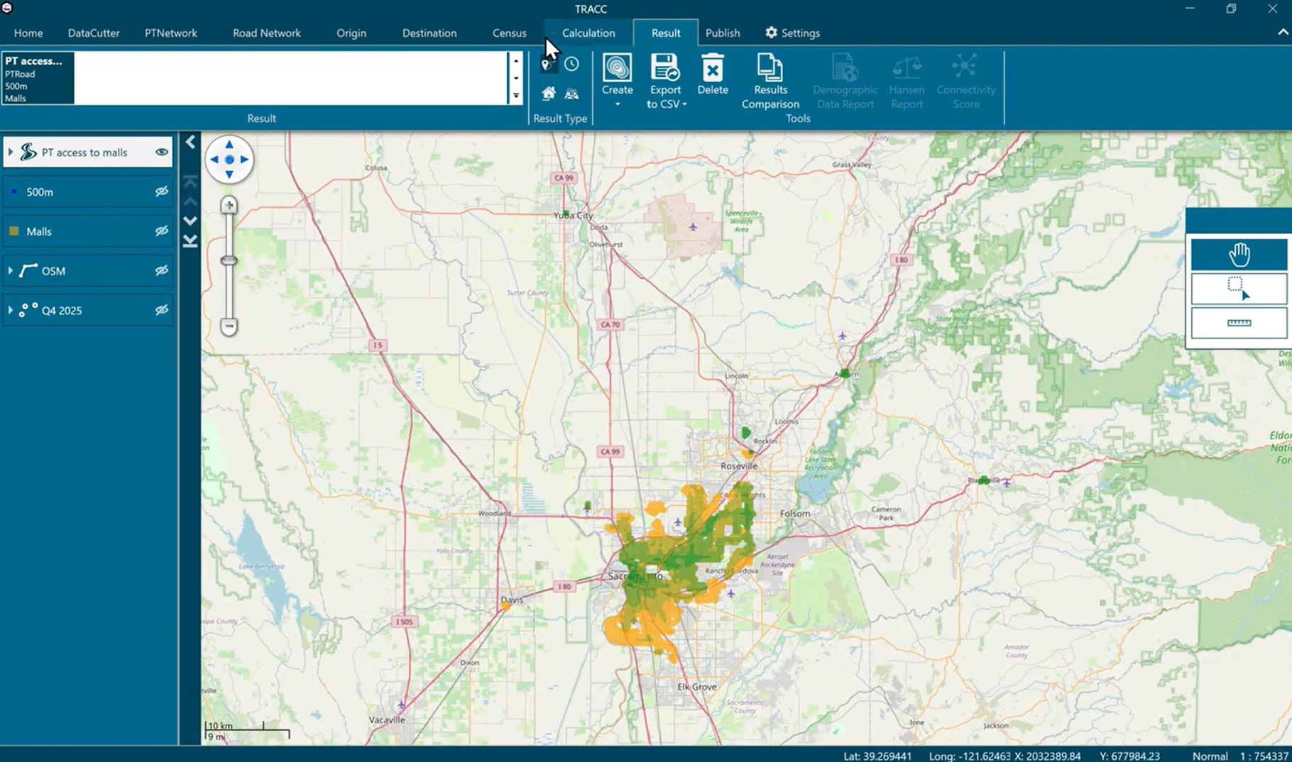
Whether you’re an MPO, transportation agency, or consultant, TRACC makes end-to-end accessibility analysis simple, from data collection to actionable insights. In this short 3-minute video, we show how TRACC, integrated with DataCutter, enables fast, defensible accessibility analysis anywhere in the United States. All the data you need is in one place: public transit networks, road networks, destinations, and census […]
Blog
The latest updates, news and stories from TRACC
How Datacutter Unlocks Access to Transit, Road, POI & Census Data
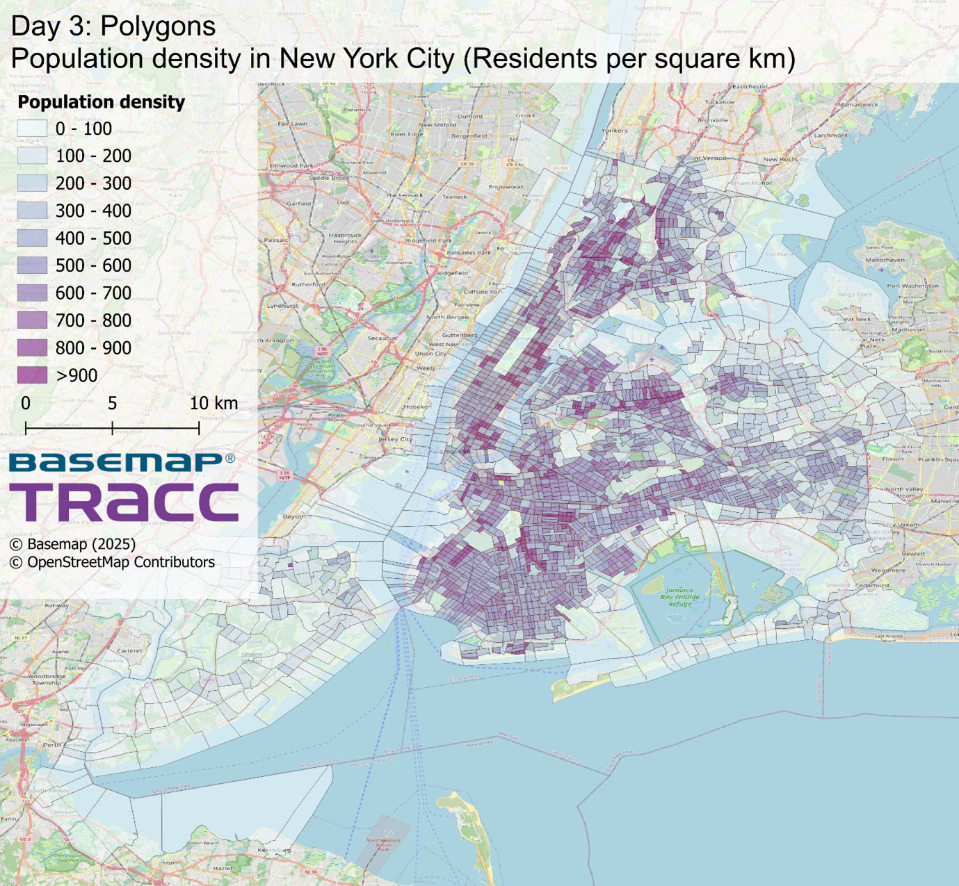
For anyone working in transportation planning, accessibility analysis, or urban development, finding the right data is often the biggest barrier to getting started. In the United States, transit schedules, road networks, points of interest, and census data exist, but they are scattered across hundreds of portals, formats, and update cycles. Datacutter brings all of these essential datasets together in one […]
The Importance of Open & Accessible Transit Data
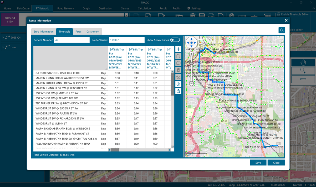
Public transit in the United States is becoming increasingly digital, but reliable datasets are only possible when transit agencies make their data open and accessible. The General Transit Feed Specification (GTFS) has become an international standard for sharing transit schedules, routes, and service changes — and U.S. transit agencies are required to publish GTFS feeds as part of National Transit Database (NTD) reporting. As […]
Redefining accessibility in St. Louis

Enhancing Accessibility Analysis Beyond the Closest Destination The East-West Gateway Council of Governments (EWG) serves as the Metropolitan Planning Organization (MPO) for the St. Louis region, representing nearly 3 million residents. Like many MPOs, EWG has long used accessibility mapping to understand how people reach key destinations. Traditionally, these maps measure travel time to the nearest single destination—for example, […]
The Return of 20-Minute Cities

Throughout 2021 we released a blog series surrounding the 20-minute cities concept where TRACC was used to analyse the accessibility to key destinations and public transport stops for 13 major cities. Join us as we take a trip down memory lane to determine which cities have since improved or dare I say worsened. As before, each analysis began by sourcing the data. […]
Subscribe to Basemap's Latest News
Latest Tweet