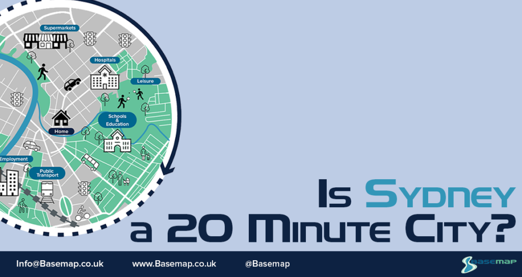
Is Sydney a 20-minute city?
We’re taking a look at international cities to find out whether they follow the 20-minute model.
For our first stop it’s to Austalia’s Emerald City, Sydney.
About the Project
Each month we are focusing on a different city and creating 5 accessibility maps based in the UK. To supermarkets, hospitals and GPs, primary schools, secondary schools, and public transport stops. We’ve added a little twist by taking a quick peek at some international cities as well to see how these fare in comparison. (To check out our UK cities, click here)
The data used for cities outside of the UK will be a little different although the structure of the maps remains the same. International cities will also begin with a foundation of a road network, predominantly taken from OpenStreetMap. On top of this, Basemap layered the public transport network, using the latest GTFS data from Transitland.
For the origins, Basemap created a grid of points based on the city boundary and then found the Points of Interest (POI) within this boundary for each destination type. This means that the accessibility to these destination points could reach beyond the city boundary but for the scope of this series we are specifically looking at the accessibility within the city limits. In an international setting the Points of Interest is sourced from various places and will be referenced for each individual city.
Struth and the results for Sydney are in…
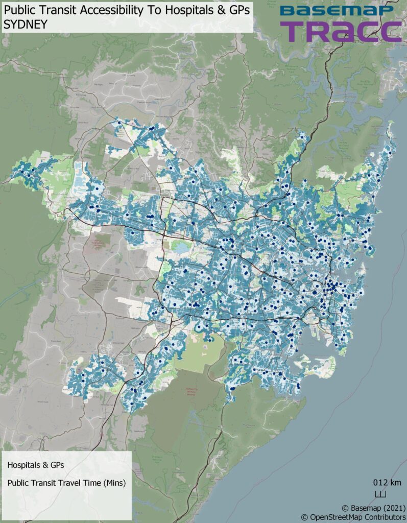
Starting with the 348 Hospitals and GP’s destination points, this already looks to be the least accessible of all the destinations, at only 86.13% for the city’s population. Not discrediting how good the overall access is for a city of its size but it’s clear there are some areas, external to those rural, where access is lacking likely because of where these facilities are based. There is a relatively even spread between the journey time ranges, but in the more Western areas more people need to travel between 10 and 20mins. Again, an increase with an even spread of Hospitals and GP’s would help with this.
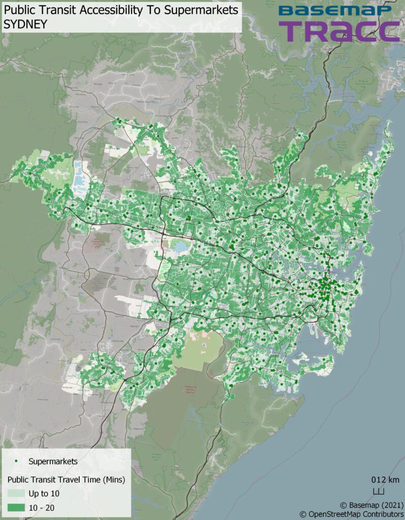
While there is a higher number of supermarkets (545) and a slight increase in access (93.97%) compared to secondary schools, you can see areas that are inaccessible closely follow the same pattern. Even though there are more destinations, most are primarily located in the city centre of Sydney making it harder for some residents, although few, to buy their shrimp for the barbie in 20 minutes.
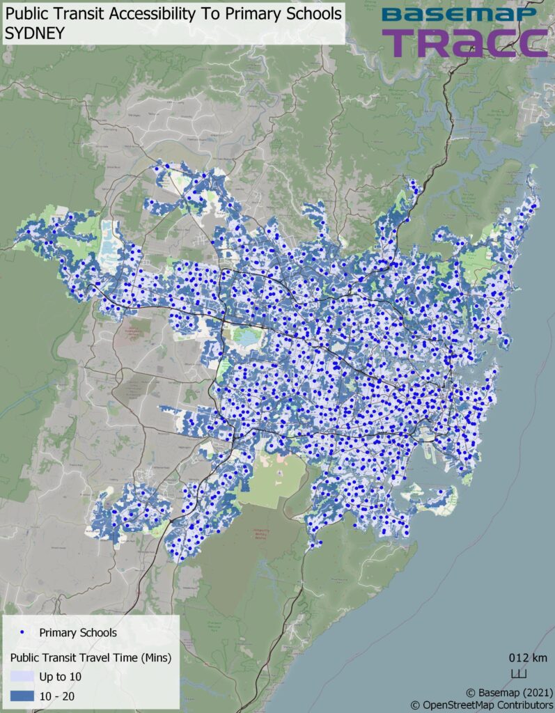
With the highest access (97.16%) out of all the destinations, there is really no Primary school that 0-15 year olds can’t access within 20-minutes, which isn’t surprising with the large number of these that are available (891). Better yet, is very few students need to travel more than 10-minutes. Any areas that require a 10-20 minute travel I put down to there being smaller clusters of schools. As expected, gaps with no accessibility are predominantly in rural areas of Sydney.
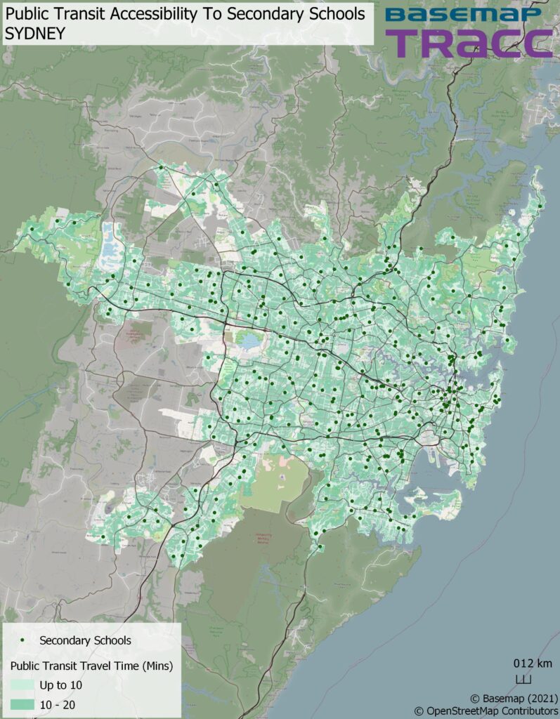
On the other hand, access to Secondary schools looks a little different for those aged between 15 and 19 years with figures as low as 92.01% making it the least accessible destination. A significant reduction in the number of secondary schools (351) available in the city looks to be the cause. There is a strong correlation between where accessibility falls outside of the 20 minutes and the lack of schools which in turn also means more students travelling anywhere from 10 to 20 minutes for education.
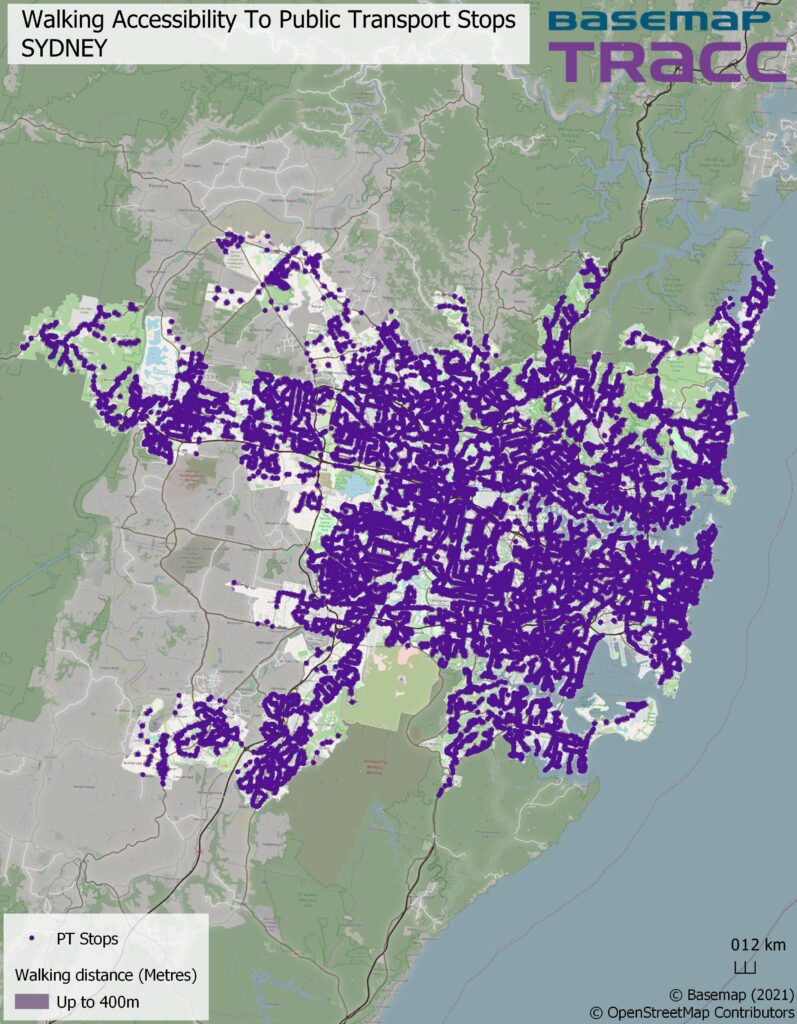
As Sydney is by far one of the largest city we’ve looked at to date, it comes to no surprise that it has a large public transport network with 20,346 stops which can be accessed on foot within 400m.
Although access at 72.85% is in no doubt at a high percentage, I am surprised that it isn’t any higher considering the number of stops accessible. However it does explain why the access to these key services are so good.
Having looked at Sydney there is a strong indication to how key the underlying public transport infrastructure can be for larger cities, especially as there would be a necessity for a strong network to ensure good accessibility in turn making some of the biggest places perhaps the most accessible. Sydney has proven itself to provide more than good enough access to its residents and in turn can be called a 20-minute city.
It has also shown there is more to having a high density of destinations and that their location is just as important.
